Twelve hectares brimming with variety: The Wilder, Wetter Caerlaverock Diaries no.6
Also known as Jake's love affair with a field. Strap in, folks. It's a long one.
Twelve hectares is not a particularly large field but it’s a big enough area to offer up huge benefits and potential benefits for wildlife. The field I’m thinking of goes by a handful of names: Sir Peter Scott called it “Lochar Field” but us modern conservationists love to parcel land into ‘compartments’ and give them a code. So most of the time this field is boringly referred to as O3. But what’s so special about this particular field? Isn’t the whole reserve wonderful? Well, you’d be right but this year, Lochar Field has peaked my interest in particular.
If you had somehow visited this field before 1861, you would have found a very different landscape than you’ll see now. At that time, there was no sea wall bordering the Eastpark fields and there was a lot less saltmarsh. The sea wall was then constructed and took land back from the estuary. The reason for this was agriculture: we needed more space to grow crops and so reclaimed land like this was highly valuable. Remnants of this land change can still be seen today in the seawall and paleochannels are still visible (more on this later!).
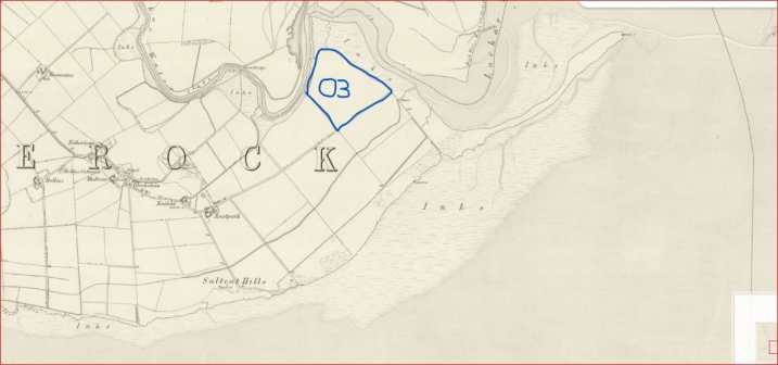
Map of the area WWT Caerlaverock now resides in from 1861. Compartment O3 marked in blue.
Going back to the 1980s, the grassland was sown with barley and sometimes a barley and grass mix. By the late 80s, this changed and a nutritious mix of grasses were grown that could be grazed by the barnacle geese. An old plan described the habitat and management for Lochar Field as “improved goose pasture, grazed, cropped and reseeded. It includes flooded flashes in the middle”. This wasn’t just O3 but the majority of the Eastpark fields (excluding saltmarsh or those that had any tidal inundation). They were managed in this way to get the best grass for barnacle geese. However, in the late 2010s the management strategy shifted slightly. The site was still managed with barnacle geese in mind but we wanted to increase the biodiversity of the reserve, build on the number of dynamic habitats we have and let nature take the driving seat in habitat management and creation. What this meant on the reserve at that time was not using fertilizer and not reseeding the grass. Other than that, the management stayed the same: a hay cut in the summer, small amounts of grazing and topping the rush to manage its dominance.
Now that’s the management out the way, let’s take a look at the finer details of this field. Looking at a picture of it from above, you might be able to see a ridge that goes through the centre of the field with colour differences in the vegetation. This ridge marks a gradient difference between the green grass portion of the field (which is raised higher and drier as it doesn’t hold water) and the lower, wetter half of the field. Because it’s drier, has better grass growth and is dominated less by rush, it is fantastic goose pasture and is grazed by barnacle geese and pink footed geese all winter. As we move into the spring and the geese move on to pastures new, we see species like ribwort plantain, ragged robin and bird’s foot trefoil, to name a few, and the list seems to get larger all the time.
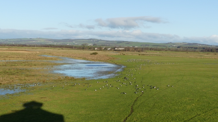
Barnacle geese using O3 in the winter of 2023/24 by Marianne Nicholson
But when you walk down the slope and into the lower half of the field you get an entirely different picture. Firstly, depending on the time of year and how much rainfall there’s been, you might be met with knee high water enough to fill your wellies or soft wet mud with only a little water on the surface. This gets even more spectacular if there’s been a high tide because of two breach points located in the sea wall.
A sea wall is a man-made bank built to stop the high tide inundating an area of land. It was a way of reclaiming this land for agriculture and also keeping said land in good condition. The breach points have naturally formed and are located in areas that feel the significant force of high tides. As the tide comes in and out, it erodes a hole in the sea wall. Most of the time this is a slow process but the forces of nature at play here are big and dramatic so every now and then you take a look at the breach point and notice it’s a lot bigger than before!
The soil type in this low-lying area of the field ranges from sandy loam, clay and even some peat. These different types of soil then have an effect on how well the ground holds water and what plant species you might find. At the south side of the low-lying areas, you might find bird’s foot trefoil, marsh bedstraw, marsh foxtail, white clover and silverweed. These species are usually dispersed between dense stands of rush showing the wet nature of the ground here.
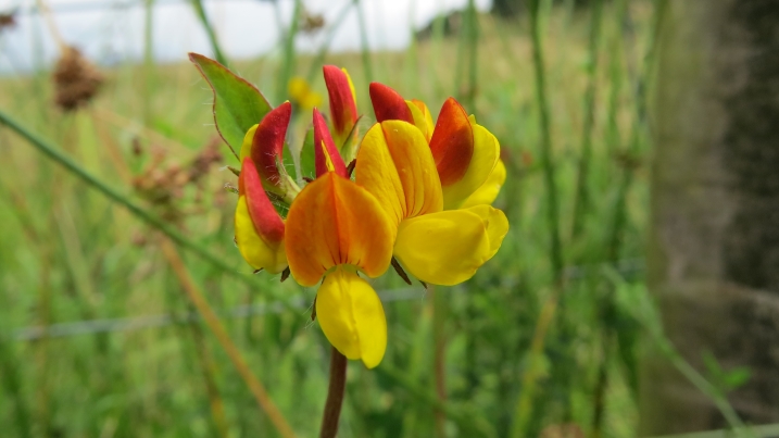
Bird's foot trefoil by Shannon Clifford
As you head to the northern end of this field, if you look closely you’ll notice some interesting features. Firstly you might notice perfect circles of cottongrass, hinting at the peaty soil below. But as you move through the south side, you can see the botany begin to show a fondness for saltwater: saltmarsh rush, parsley water dropwort and sea arrowgrass show the salinity might be rising here due to the breach points. As the sea wall becomes weaker and the breach points bigger, will this change accelerate and will more saltwater specialists appear? It will definitely be something we keep an eye on and assess its evolution.
The top of the interesting features list? The numerous low-lying channels and pools that hold water in the winter and this is where the Wilder, Wetter Caerlaverock project comes in.
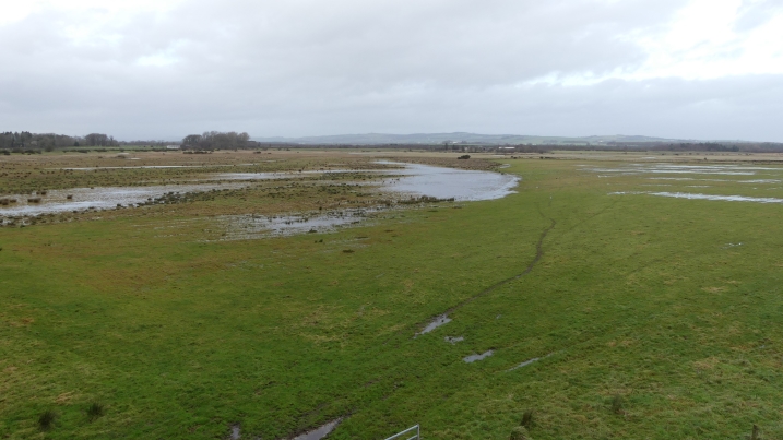
O3 in winter before any work was done
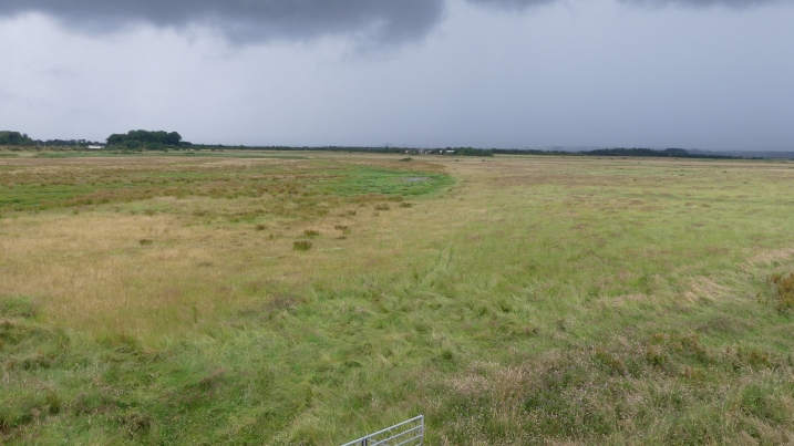
O3 in summer before any work was done
A key aim of the project is to promote wet grassland and create scrapes and channels to benefit a wide variety of wildlife like waders, waterfowl, invertebrates and insectivorous species. Once you have this target, decisions have to be made as to where you create these habitats. We do this in a number of ways.
One thing is to look at LIDAR (this uses laser light to show low and high points in the ground's surface). This can inform you of the lower parts of fields where the water table will be at its highest thus keeping potential scrapes in water for a longer period. As well as LIDAR, we also walk and watch the fields on the reserve, noting which bits are extra rushy and likely wetter, where there are visible dips and low points, which bits have surface water and how long it takes them to drain when rainfall decreases. Lastly knowing your soil type really helps. Clay and peat will hold water a lot better than soil that’s stoney for example.
We used these techniques to decide that the Lochar Field would be perfect for this work. We started this August, beginning by trench bunding along the north western portion of the field. Trench bunding is a technique where field drains installed to remove water are blocked. This helps areas hold onto water for as long as possible, both keeping the water table topped up and water on the surface. Nearly 500m of field drains were blocked and by the end of it, it already looked like there was an effect on the field… but maybe that was more wishful thinking than anything else – time will tell. Then scrapes and channels were put in that we hoped would take advantage of the water table. The main target was to create a channel about 250m long and 3m wide in most places.
This channel was created in an old paleochannel which already held some water during the winter period. A paleochannel is an ancient channel that used to flow water. In this case, it was probably an old saltmarsh creek before the land was reclaimed for growing food. We also created scrapes within the channel of varying sizes which should help keep them topped up with water. Some smaller scrapes not connected to channels were created as well.
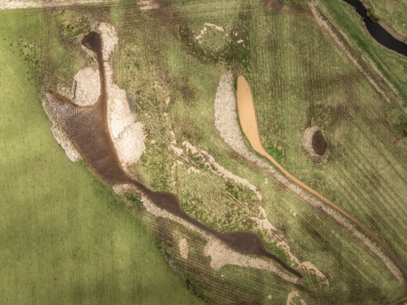
O3 after the digger work was completed by Ted Leeming
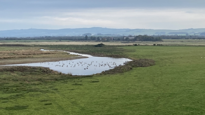
Ponds and scrapes in O3 being used by wildfowl
This is beneficial because having scrapes that drain at different times of the year can be very valuable to waders and invertebrates. In addition, during our natterjack toad monitoring this summer we noticed males singing from the Lochar Field. They hadn’t been heard in that field before but there also wasn’t really any water bodies in there that would be suitable for natterjacks as breeding pools… on paper anyway! Perhaps the increased activity in this field was because it held more water this year due to the wet spring and summer? Normally most of the surface water has drained away in the warmer months which never happened this year. Or perhaps the number of high tides was pushing saltwater through the breach points and into the field has increased the salinity enough to attract the natterjacks? This evolutionary tactic provides natterjacks with a niche so they can live alongside common toads that would outcompete them if using the same ponds.
With the increased salinity levels in the field from the breach points, we might be seeing a change in habitat like we’re seeing with the changing plant community. With this in mind, smaller scrapes were included with some disconnected from channels as these will warm up quicker when the water level drops in the spring – a feature natterjacks look for in breeding pools.
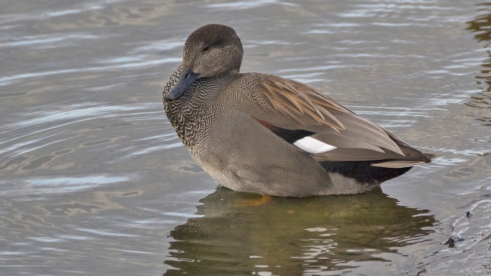
The digger work has only been completed for a couple of months but we’re already seeing the benefits of wetland creation in this field. Within the first week, a very high tide had pushed through the breach points pushing waders like dunlin and ringed plover into the field feeding along the spoil banks made from the scrapes and channels. Over 300 were counted. Since then we’ve seen groups of little egret feeding along the pools, ducks have been increasing over autumn with shoveler, teal, wigeon and mallard feeding in the pools and banks. We’ve even had a little grebe feeding in the channel indicating the high tide in the first week may have also brought in fish to the channels. Our barnacle geese also seem to be loving the new water bodies, feeding on the grasses on the margins of the scrapes and even having the odd bath! What else might we see as these new wetlands change over time?
This project is supported by the Scottish Government’s Nature Restoration Fund, managed by NatureScot.
Words and pictures by Jake Goodwin
